ISO 9001:2015 & ISO 27001:2013 Certified Organization
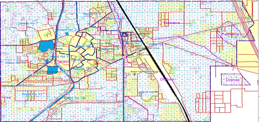
The scope of assignment included preparation of Digital Sajra Based Municipal Area Map/Key Plan of MC; extract of area in acre along with khasra no. and indication the municipal boundary with dimensions; digitization of existing streets/roads pattern of the each colony/area along with length and width, GPS coordinates starting/end points (latitude/longitude) of each street; assigning a unique street code and name as per locality/ward; assigning boundary of each MC ward and name of colony/mohalla; mapping of existing service i.e. roads, water supply line, drainage, electricity, street lights and sewerage; mapping of community facilities i.e. park & schools, dispensary, temples, community centre etc.; and mapping of the location of government land/ municipal committee land with dimensions.